You think we have high gas prices on the East Coast of the US, huh? Well look at this–Unleaded plus $2.11!!! This is the cheapest we've found anywhere on the island–near the airport in the only city (Ha!) on The Big Island, called "Hilo". This is the side of the island where the volcano is and where they have an industrial shipping port (which is why the gas is cheaper). The most expensive gas we've seen so far–in Kona at a Shell for $2.52 for unleaded plus! Scary, huh? |
|
You can take a less expensive helicopter tour of the volcano in Hilo then if you leave from our side of the island (Kona). The tour on our side gives you just as much time on the volcano but it takes about another hour or so to fly out there and so the extra money you spend is basically to see coastline and for gas. |
|
If you are ever interested in taking a helicopter tour of any of the islands–specifically the Big Island, Eric and I will swear by "Blue Hawaiian Helicopters". We've gone with them three times and they are the best. They aren't cheap but you get your money's worth. For a slight extra charge you get a video of the trip from several outside cameras and an inside camera of the helicopter with the pilot's voice narrating your trip AND really nice music for background. |
|
|
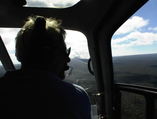 This is our pilot, Darl. If you look slightly to the right of his face you can see our first shot of the active part of Kilauea. We've been on this trip two times before this and one of those two times Darl was our pilot. He's a great helicopter pilot (according to Eric who should know) and a very amusing and informative narrator to the trip. This is our pilot, Darl. If you look slightly to the right of his face you can see our first shot of the active part of Kilauea. We've been on this trip two times before this and one of those two times Darl was our pilot. He's a great helicopter pilot (according to Eric who should know) and a very amusing and informative narrator to the trip.
They offer two different tours. If you aren't going to Kauai (best waterfall and coastal helicopter tours–but Blue Hawaiian doesn't have a location there, you'll have to use someone else) later I suggest the volcano and waterfall tour. If you just want to see the volcano get the volcano only tour. It's a little cheaper and you aren't up in the air as long and you focus (unless the weather is bad) JUST on the volcano and the surrounding lava fields. Last two times we've taken just the volcano tour because EVERY visit to the volcano is totally different–weather-wise and volcanic activity wise. |
|
This is a lava field made up of what looks to be pa'hoe'hoe lava, which is the smooth, shiny kind that seems to harden in waves and bubbles. This type of lava cools more slowly then the other type of lava you will see in these photos which is called a'a'. A'a' is a chunky darker color (usually brown) and has cooled very quickly. I took this shot to show how oddly a lava flow can move–see how it went around this stand of trees while it demolished the rest of the forest around it. No one knows why it does this–lava can be very unpredictable. |
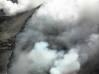 Our first close up of the currently active area of Kilauea, called Puu' o'o'. Puu'o'o' is a cone made of volcanic ash. It is on top of a 'vent' which is a currently active lake of lava. Right now most of the Puu'o'o vent has covered over it's active lake of lava with a thin (by geological standards) layer of volcanic rock. Within that layer are broken areas called "skylights" where you can see the bright orange lava flowing down the lava tube on it's way down the slope of Hawaii to the sea. Also there are huge steam vents that are constantly spewing out steam and noxious gases. The weather this day was the best ever in the three times we've gone here and it's the closest we've ever gotten to the Puu'o'o vent. Unfortunately, even though I could see a couple skylights in the vent, by the time I would get my camera centered another puff of steam would blow up and obscure it. Our first close up of the currently active area of Kilauea, called Puu' o'o'. Puu'o'o' is a cone made of volcanic ash. It is on top of a 'vent' which is a currently active lake of lava. Right now most of the Puu'o'o vent has covered over it's active lake of lava with a thin (by geological standards) layer of volcanic rock. Within that layer are broken areas called "skylights" where you can see the bright orange lava flowing down the lava tube on it's way down the slope of Hawaii to the sea. Also there are huge steam vents that are constantly spewing out steam and noxious gases. The weather this day was the best ever in the three times we've gone here and it's the closest we've ever gotten to the Puu'o'o vent. Unfortunately, even though I could see a couple skylights in the vent, by the time I would get my camera centered another puff of steam would blow up and obscure it. |
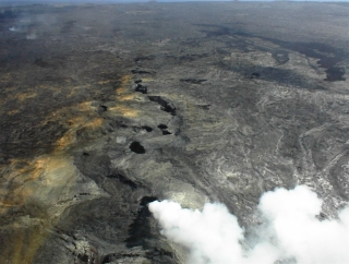 A picture of two relatively new steam vents just slightly southeast of the Puu'o'o vent. The first one is very active right now as you can see. The other one is currently inactive. Perhaps because the lava cooled in such a way to block it off from future lava flows at the current amount of pressure. That could change any day or time of course–a magma bubble could get pushed up and the pressure could cause the inactive vent to start gushing out steam or, even lava. A picture of two relatively new steam vents just slightly southeast of the Puu'o'o vent. The first one is very active right now as you can see. The other one is currently inactive. Perhaps because the lava cooled in such a way to block it off from future lava flows at the current amount of pressure. That could change any day or time of course–a magma bubble could get pushed up and the pressure could cause the inactive vent to start gushing out steam or, even lava. |
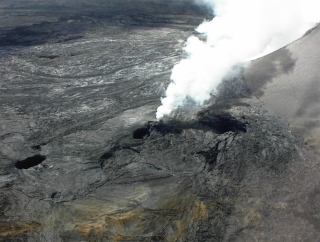 A close up of the active steam vent southeast of the Puu'o'o vent. I believe they've actually named this vent but off the top of my head I can't remember what it is. If I find out what it is I'll correct this portion of the website. A close up of the active steam vent southeast of the Puu'o'o vent. I believe they've actually named this vent but off the top of my head I can't remember what it is. If I find out what it is I'll correct this portion of the website. |
|
The pa'hoe'hoe is to the far left, then the darker a'a, then the foliage (well okay that last one is a no-brainer!). We found out that the ancient Hawaiians made their foot trails through the pa'hoe'hoe because it was easier to pack it down flat to walk on. Modern Hawaiian road and construction crews prefer working with a'a because it breaks up better with modern equipment, while pa'hoe'hoe is not only harder to break, it also breaks in ways that can cause problems because it has layers of air trapped in-between the layers of volcanic rock which can really send things shooting out in all directions under pressure. |
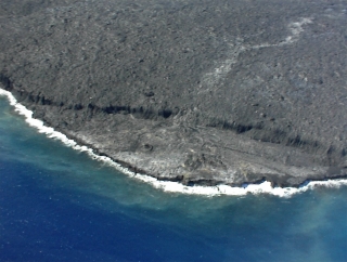
This is what is known as a lava shelf which is a thin crust of pa'hoe'hoe that has come out of ocean surface layer lava tubes and has formed as a part of the coastline. Trouble with this stuff is that although it looks like a permanent part of the coastline, it's usually very temporary. People have died ignoring warnings by the park rangers not to go out and hike on the shelves. The hikers fall into the ocean with the rocks when the shelf collapses (which they do during the constant small earthquakes they have in the Kilauea area) and if they don't drown then they get tossed up on the rocks with the rough surf and battered to death. Not a fun way to die if you ask me. |
|
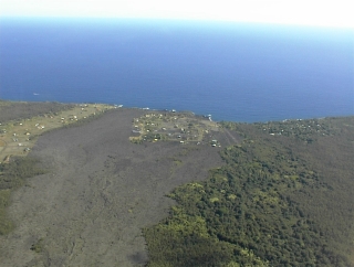
Okay, this is the last "lava only" picture. The only reason I put it up here was so you could see a subdivision of houses that was ruined by one of the eruptions since 1983 from Puu'o'o vent. I think this is the "Royal Gardens" subdivision. Some of the houses are still there, but I'm not sure if anyone still lives there as they seem to have no road access and they are in a very high risk zone for another eruption. Our pilot, Darl, was making funny jokes about cheap real estate. There is a big deal made around here about the 1983 eruption because it ruined a community called "Kalepana" which had lots of great self-designed houses and which was completely covered over by that flow. No one died thank goodness, but the people that lived there were heartbroken. The state also lost one of it's precious "black sand" beaches. Still, you know how the black sand gets there? You got it, some ancient lava flow that has been beaten to bits by the sea and settles in a cove. Sort of a poetic ending to the beach if you ask me–becoming part of the magma it once was a part of again. Almost a "life cycle" for the lava if you think about it. |
|
Enough said. |
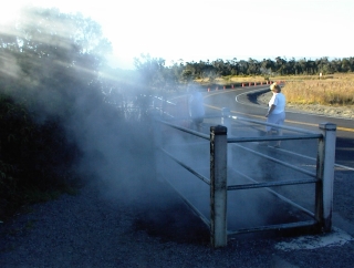 This is a shot of one of the steam vents near the road you drive on to get down to the Chain of Craters road for nighttime lava viewing. The steam that comes from these vents is fairly harmless and has been for a long time. Mostly just regular old steam with non-noxious gases mixed in with it–although I wouldn't recommend standing around and breathing it for long periods of time. I have breathed it and it doesn't have much of an odor nor does it cause me to cough. It's very warm steam though and would not recommend anyone standing right over the exit of the vent for a steam facial–or your face just might cook! This is a shot of one of the steam vents near the road you drive on to get down to the Chain of Craters road for nighttime lava viewing. The steam that comes from these vents is fairly harmless and has been for a long time. Mostly just regular old steam with non-noxious gases mixed in with it–although I wouldn't recommend standing around and breathing it for long periods of time. I have breathed it and it doesn't have much of an odor nor does it cause me to cough. It's very warm steam though and would not recommend anyone standing right over the exit of the vent for a steam facial–or your face just might cook! |
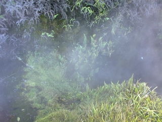
A close up of the inside of a different steam vent where, since the last time we saw it two years ago when it was just bare volcanic rock, has started fern growth at the vent's exit point. This means two things–the steam from this vent is cooling down enough so it doesn't "cook" the ferns and that there aren't too many noxious fumes as in the areas where there is lots of sulfuric acid gas coming from vents there is not vegetation growth. Of course, these conditions in this vent could change at any time. I was really impressed with the change in the conditions of this vent in the last two years and had to take the pictures of these ferns to remember it so that the next time we come we can track the development (or destruction) of vegetation near these vents. |
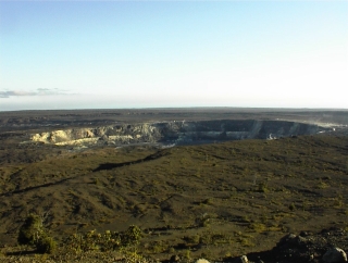
A view of the Kilauea caldera from the Jagger observatory, which is located on the outer rim of this caldera. You can go inside and look at the tilt meter and seismic readings. It's really a cool little observatory. Jagger was the first scientist to try to set up a methodology to observe and study volcanoes in a scientific way. Since Kilauea is the most active of all volcanoes on a long term basis, this was the perfect place to set up his observatory. |
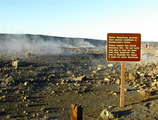 A view of the steam vents in the Kilauea caldera leading up to the Halemaumau crater. These steam vents are definitely still over active magma because they are spewing different amounts of sulfuric acid and other mineral gases as well as steam. You can hike into this area (which we always do as this is not the "super dangerous" gas area) but there are warnings about hiking in this area if you are pregnant, have heart or breathing problems posted all over the place in the parking lot. A view of the steam vents in the Kilauea caldera leading up to the Halemaumau crater. These steam vents are definitely still over active magma because they are spewing different amounts of sulfuric acid and other mineral gases as well as steam. You can hike into this area (which we always do as this is not the "super dangerous" gas area) but there are warnings about hiking in this area if you are pregnant, have heart or breathing problems posted all over the place in the parking lot. |
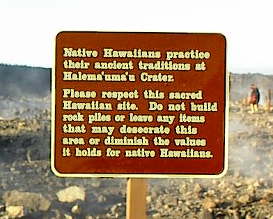
A close up of the sign that tells visitors to please respect the area where those Native Hawaiians that still practice their old religion have their ceremonies. Lots of hula schools make a pilgrimage here each year as well, although I'm not sure why as I believe the "hula" was given to the Hawaiians as a gift from Pele's sister (or one of her rival goddesses). I'm not sure about this though, like a dope I left my Hawaiian mythology book at home so I will have to look it up and update the website when I get home. Except for the areas that are on Native American reservations, I believe that Volcano National Park in Hawaii is one of the few (if not only one) national park areas that has put aside sacred land for the modern rites of the native pagan religion practitioners. I salute Volcano National Park on this! |
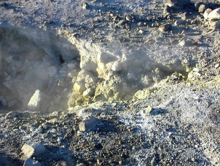 One of the steam vents at the rim of the Halemaumau crater that was currently spewing large amounts of sulfuric acid as well as steam and some mineral gas that left white as well as the yellow (sulfur) deposits. Most of these type of vents are deep in the crater so I felt pretty lucky to get a shot of this. One of the steam vents at the rim of the Halemaumau crater that was currently spewing large amounts of sulfuric acid as well as steam and some mineral gas that left white as well as the yellow (sulfur) deposits. Most of these type of vents are deep in the crater so I felt pretty lucky to get a shot of this. |
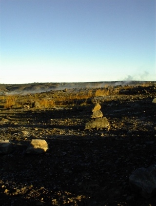 An unadorned rock altar (I forget the Hawaiian word I will look it up later) on the steam vent hiking area. Often you will see leis (flower necklaces) draped on top of these. The last time we were here two years ago everything was draped and decorated, so I guess we had just missed a ceremony the day before. An unadorned rock altar (I forget the Hawaiian word I will look it up later) on the steam vent hiking area. Often you will see leis (flower necklaces) draped on top of these. The last time we were here two years ago everything was draped and decorated, so I guess we had just missed a ceremony the day before. |
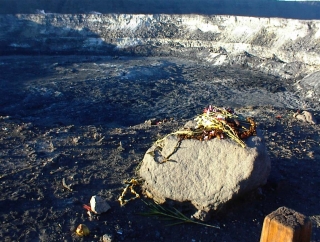
This rock was the only "adorned" altar area that I saw. It is at the top of the lookout area and the only one that non-native Hawaiians seem to leave offerings on–although it is blocked off you can still throw flowers on it. Besides, if your offering misses, it will end up in the crater, and therefore all the closer to Madame Pele, which seems acceptable to me. I'm not sure if the tale I heard about this being a sacrificial jumping off point for the ancient Hawaiians is true. How would anyone really know? The landscape of the crater has changed many times over the centuries. We saw some non-Native Hawaiians bringing flowers for offerings, and I was curious as to their story, but of course too polite to ask. |
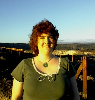 The sun is in my eyes and the wind was blowing furiously up here on the Halemaumau Crater hiking trail. It doesn't look like it (squinting make me frown), but I am having a great day!!! The sun is in my eyes and the wind was blowing furiously up here on the Halemaumau Crater hiking trail. It doesn't look like it (squinting make me frown), but I am having a great day!!! |
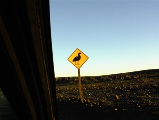
No, this is not a sign to warn you of duck attacks. This is a "Ne Ne crossing" sign. They are all around the state park roads as these guys are one of the few indigenous Hawaiian birds that have not been put on the "extinct" list. They are considered "endangered". These birds sort of look like black and white geese if you are lucky enough to see them. We haven't seen them live yet, only in pictures. They mostly cross the roads at dawn and sunset/twilight, so we were hoping to see one, but we didn't. We did almost hit a pheasant going down the Chain of Craters road. It ran out of the foliage at street level at sunset and we almost didn't see it. Eric slammed on the brakes (thank goodness no one was behind us!), and luckily the pheasant took off at the last second (this is the way we found out what kind of bird it was–by it's plumage as it flew–before then we had no idea what kind of bird it was. Pheasants are not native to Hawaii but were brought by Europeans for eating. Glad we didn't hit it! Even though pheasants are not native to this island I don't think it would have been good juju to kill it in a state park–especially one watched over by Madame Pele! |
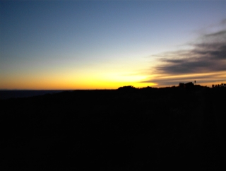 A beautiful sunset looking out over the lava field and the ocean. I missed the sun going down by moments, but actually the colors were much better after the sun went down this time–I'm not sure why. A beautiful sunset looking out over the lava field and the ocean. I missed the sun going down by moments, but actually the colors were much better after the sun went down this time–I'm not sure why. |
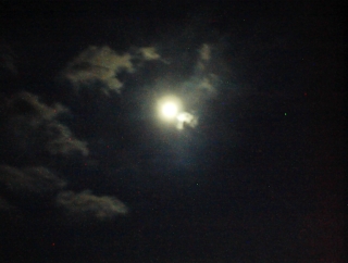
After sunset we walked out several hundred yards in the dark through a lava field (considered a safe part right now) to enjoy the lava viewing at night. The going was made much easier with the gorgeous full moon and clear skies lighting our way. I wish my camera could have gotten a better shot of this moon, it was incredible! This evening was so full of spiritual power and feelings! We were surrounded by air (the sky), water (the Pacific Ocean), fire (the lava issuing from Puu'o'o vent) and earth (the volcanic rock of past eruptions). Never have I been in this park when the weather was so perfect! |
|
This is the only semi-decent shot of the lava flowing down the vent slope that Eric and I could get with the digital camera. Let me tell you the beauty and power of this lava viewing was beyond description! We've never seen surface lava before, only the stuff pouring out of the lava tubes into the ocean on our first visit and this was such a different experience! In one way more peaceful, as there were no explosions of sparks as the lava hit the water, in another way it was more dramatic because there was just so much lava moving slowly down the slope lighting up the night sky! Eric got much better video on our video camera with the great zoom lens, so when we get home and can "capture" it we will put it up on the website so you can see how incredible the lava really was that night. We were told by the park rangers that this surface lava flow is very rare–usually it cools very quickly and forms lava tubes so that the magma flows under the tubes and then no lava is visible above ground until it pours into the sea (if it even is at the surface level, which it might not be, in that case never visible). This surface flow has been going on since mid-December which is "a gift" from Pele to all of us. We certainly felt blessed! Mahalo Madame Pele!!! The day and evening were perfect in every way! |
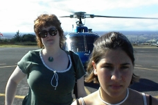
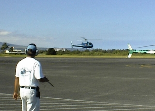 Okay this is our helicopter coming in to pick us up. This is for you aviation freaks out there. We are waiting on the tarmac and will walk over to it and they load us up and we go. That simple.
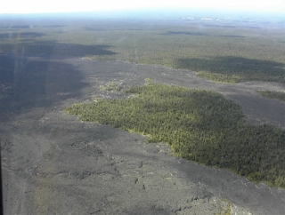
 A shot of the two types of lava and again some foliage that went undisturbed by that particular lava flow for some unknown reason.